
From Wildfire Mitigation to Resilience
Credit: El Dorado and Georgetown Divide Resource Conservation Districts
Priority Areas of Focus
The wildfire hazards and risks to communities in our headwaters are significant; however, customized strategies from mitigation to resilience are required to fit local conditions. Leveraging ongoing momentum of wildfire hazard mitigation and investment preference in landscape-scale projects, Headwaters Connect members met in December 2024 and identified five priority areas for wildfire mitigation and community resilience with continued development of mutually supportive actions and projects (in alphabetic order).
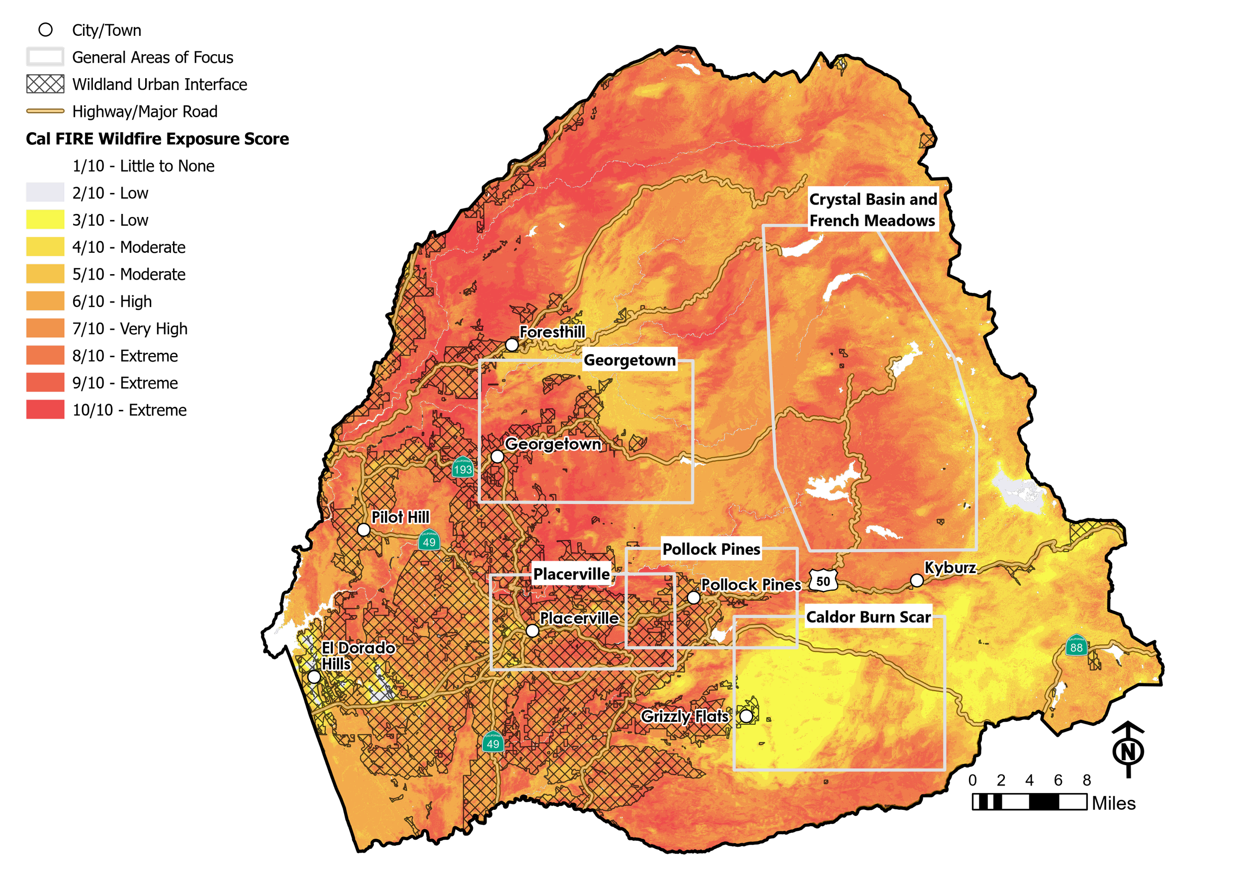
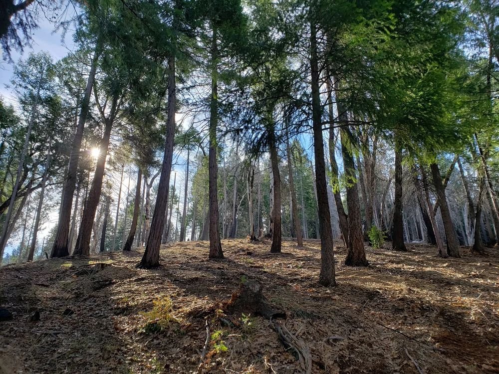
Crystal Basin and French Meadow Areas
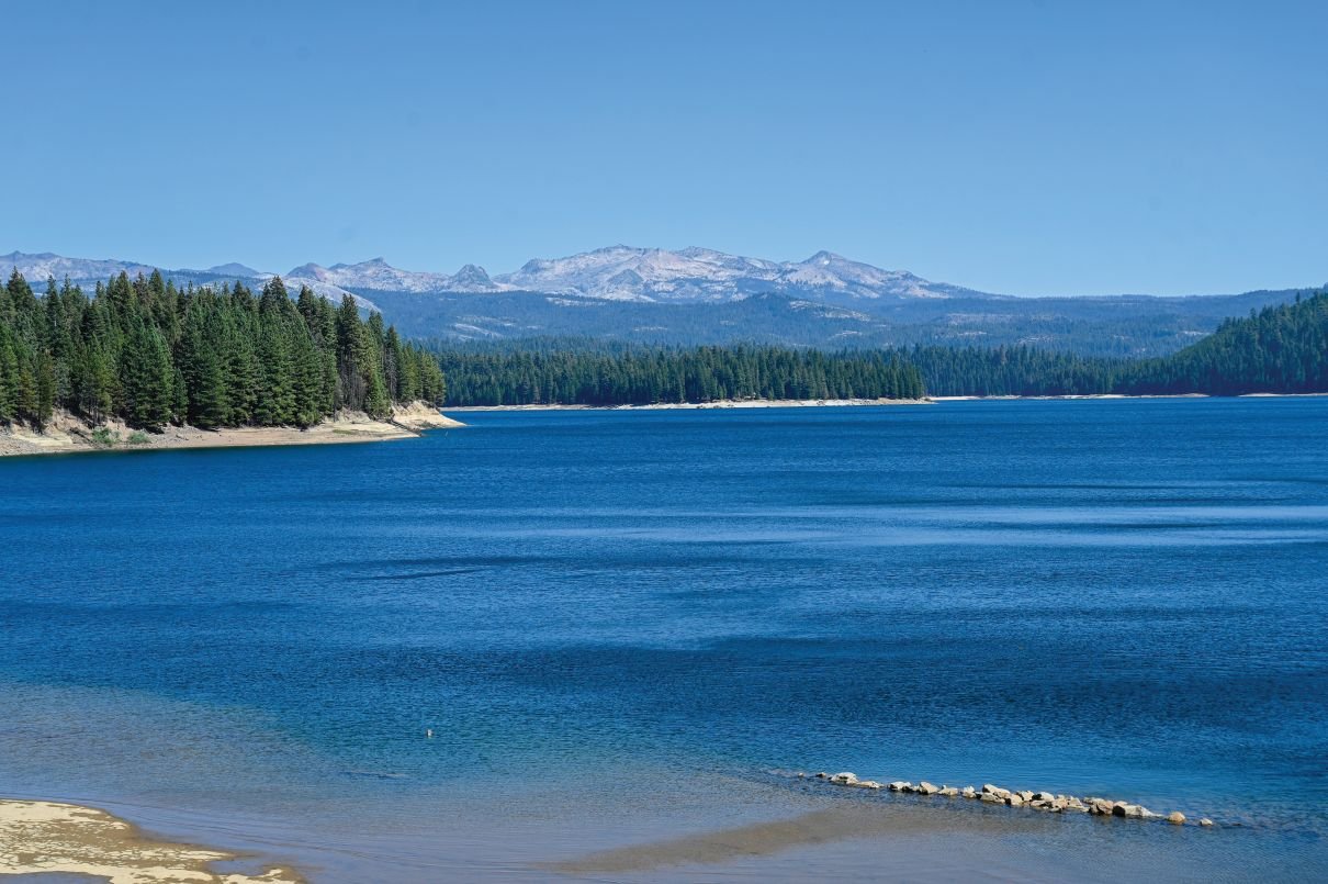
High-elevation national forest areas with challenging terrains and major outdoor recreation assets and habitat values, as well as major water and hydropower critical facilities.
-
Hazardous fuel reduction (250 ac) and meadow restoration (70 ac) to protect resident communities and recreation areas, and preserve forest health.
Lead: Eldorado National Forest, US Forest Service
Learn More
-
French Meadows Ecological Forest Restoration Project - A groundbreaking initiative covering 22,000 acres of National Forest System lands and 6,000 acres of private land. This project aims to enhance forest resilience and minimize the risk of severe wildfires that could harm habitat, disrupt water and power supply and impact vital resources for county residents and downstream communities.
Lead: Placer County Water Agency
————————————————————————————————————
Healthy Eldorado Landscape Partnership’s (HELP) Crystal Basin Project - This project is focused on fuel reduction and recreation infrastructure improvements in the Crystal Basin, a scenic island of green forest and mountain lakes surrounded by large, high-severity burn areas created by the 2014 King Fire and 2021 Caldor Fire.
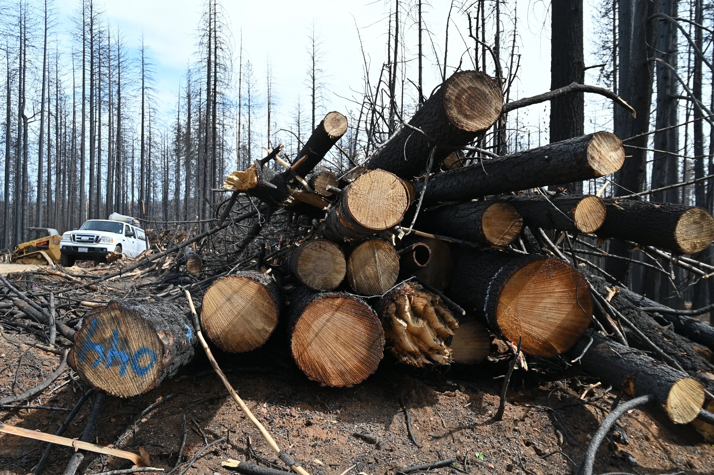
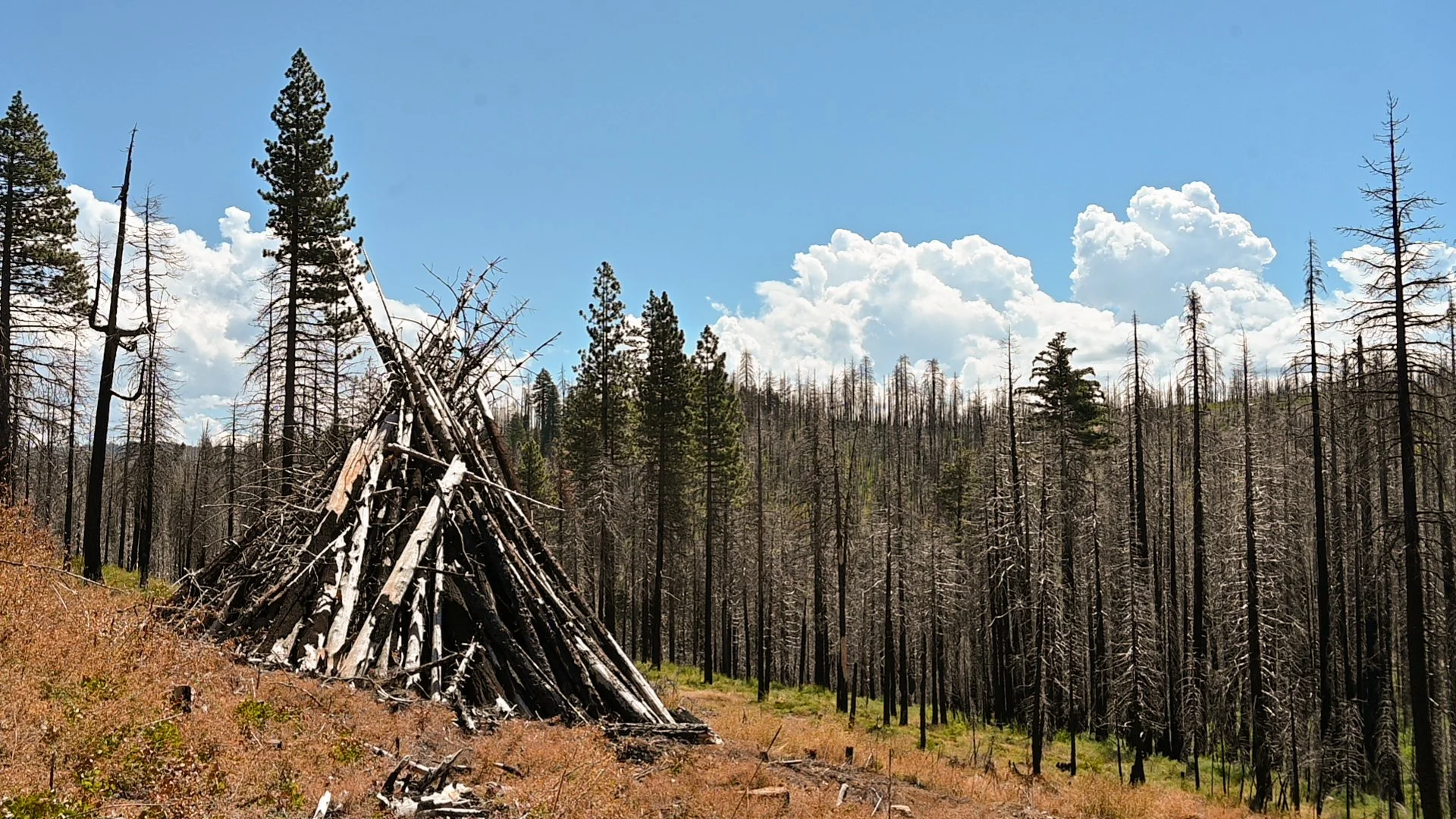
Caldor Fire Burn Scar Area
An area within Eldorado National Forest with scattered private lands and small rural communities that are in need of major actions including removing hazard trees, clearing debris, stabilizing slopes to prevent erosion/flooding, and planting native seedlings.
-
Source watershed restoration for Grizzly Flats community that uniquely leverages multiple federal and state grant fundings and implementation expertise.
Lead: El Dorado Water Agency; El Dorado Resource Conservation District
Learn More
-
Caldor Fire Forest & Community Restoration Project - Hazardous tree removal for small, private forest landowners.
Lead: El Dorado Resource Conservation District
————————————————————————————————————
Caldor Fire Restoration Project (Maximum Extent Scenario) - Project activities include hazardous tree removal, reforestation, invasive plant treatments, recreation restoration, and other watershed improvements.
Lead: U.S. Forest Service, Eldorado National Forest
Georgetown Area
An area with communities in the Wildland-Urban Interface straddling the boundaries of Eldorado National Forest and adjacent to Mosquito Fire burn scar area.
-
Slope stabilization, hazardous tree removal, and reforestation to restore the source watershed for rural communities in the Georgetown area.
Lead: U.S. Forest Service, El Dorado Water Agency
-
El Dorado County Wildfire Strategy - Creating fire-adapted communities through a countywide wildfire protection strategy that includes public outreach, collaboration, and policy (e.g., defensible space, home hardening, and others).
Lead: Office of Wildfire Prevention and Resilience Office, County of El Dorado
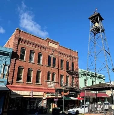
Placerville Area
Population centers outside of National Forests with urban critical infrastructure along major transportation corridors for residents, businesses, and tourists.
-
Placerville Wildfire Resilience Strategy - Implementation of the City of Placerville Community Wildfire Resiliency Plan, with prioritizing, designing, and executing landscape-level forest health and wildfire resilience projects, supported by regional stakeholders.
Lead: El Dorado Resource Conservation District
Learn More
————————————————————————————————————
El Dorado County Wildfire Strategy - Creating fire-adapted communities through a countywide wildfire protection strategy that includes public outreach, collaboration, and policy (e.g., defensible space, home hardening, and others).Lead: Office of Wildfire Prevention and Resilience Office, County of El Dorado
Pollock Pines Area
Communities within the Wildland-Urban Interface straddling the boundaries of Eldorado National Forest with complex jurisdictions and critical water and hydropower infrastructure.
-
Fire Adapted 50 - Fuel Management initiative using an “all-lands” approach to protect the Highway 50 corridor, critical water and hydropower infrastructure, and adjacent communities.
Lead: El Dorado Resource Conservation District
Learn More
——————————————————————————————————
El Dorado County Wildfire Strategy - Creating fire-adapted communities through a countywide wildfire protection strategy that includes public outreach, collaboration, and policy (e.g., defensible space, home hardening, and others).Lead: Office of Wildfire Prevention and Resilience Office, County of El Dorado